About Map Pilot for DJI
Collect better data for better results on any photogrammetry software or cloud processing solution! Map Pilot helps you create and fly the optimal flight path to create great maps using the Maps Made Easy map processing...
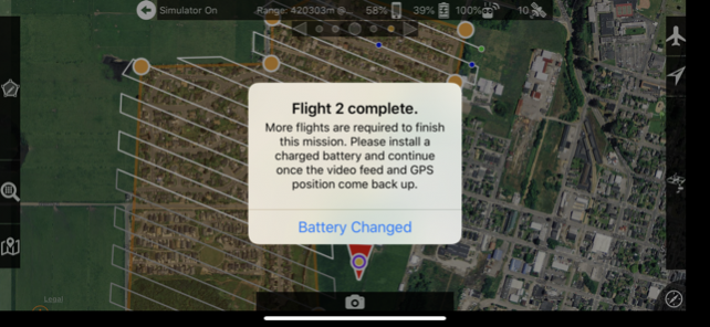
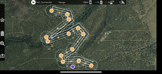
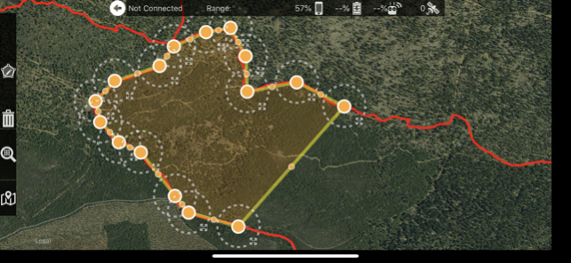
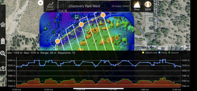
Collect better data for better results on any photogrammetry software or cloud processing solution! Map Pilot helps you create and fly the optimal flight path to create great maps using the Maps Made Easy map processing service. Collecting great data to create high resolution aerial maps with your DJI flying camera is just a few clicks away. Process into the final product using your own photogrammetry software or our Maps Made Easy online service. Mapping has never been easier. Process unlimited jobs of up to 400 images (12 megapixels) for free with Maps Made Easy. Get Map Pilot Business instead of this app to get all of the In App Purchases included by default and save money in the long run. View Full Documentation: http://support.dronesmadeeasy.com Define the area, select the level of detail, and go. Features: Multi-Battery Management Manual Restart Point Selection FlightSync to Maps Made Easy Mission and Boundary Sync with Maps Made Easy Flight Zone Management Manual Restart Point definition LAANC Authorizations via AirMap Automatic, Aperture/Shutter Priority and Manual Exposure Modes Basemap Caching for Offline Operations Connectionless Camera Triggering External Map Data and Markers via MapBox Terrain Aware Image Footprint Display Fully Offline Capable Terrain Awareness (IAP) Multi-Pass Linear Mission Planning (IAP) Custom Terrain Data Import 3D Grid Mission Planning Multi-Flight Coordination Movable Home Point to Track the Pilot (IAP) Save/Edit Missions Refly Saved Missions View 3D logs on-device with Google Earth Import KML via Email or AirDrop Export KML, log files, and Flights file via Email or AirDrop Flight Log review Built-in Simulator for testing AirData upload from Log File Manager RAW imaging available via In App Purchase Fullest Possible Use of Each Battery Appropriate Camera Triggering Overlap Management Speed Management Automatic Takeoff and Landing Live Video Preview (large and small) Signal Quality Warning Line of Sight Indicator Automatically Captures Elevation Reference Image (Ground Image) Natural Landing Assistance Live Map View Compatible with iOS 12 and iOS 13. Supported Aircraft: See our site for the full list - https://support.dronesmadeeasy.com/hc/en-us/articles/205704366-Supported-Hardware Mavic Pro Mavic Air Mavic 2 (Pro, Zoom, and Enterprise) Phantom 4 Phantom 4 Pro * (v2 included) Phantom 4 Pro RTK (with DJI SDK remote from Drones Made Easy) Phantom 4 Advanced Phantom 3 Professional Phantom 3 Advanced Phantom 3 Standard Inspire 1 Inspire 1 Pro Inspire 2 Matrice 100 (M100) Matrice 200 (M200) Matrice 210 (M210) Matrice 210 RTK (M210RTK) Matrice 600 (M600) Matrice 600P (M600P) Supported External Cameras: DJI X3 DJI X5 DJI X4S DJI X5S DJI XT2 Sony a7R, a7R II, and a7R III only with Drones Made Easy trigger board* Sony A6000 only with Drones Made Easy trigger board* Sony Multispectral Camera (MSZ-2100G) as part of the Drones Made Easy and Sony Smart Agriculture Solution * Matrice 200/210/600/600P with Sony a7R and other custom camera sensors will require a Drones Made Easy custom trigger board that will only be sold as fully integrated kits built by Drones Made Easy. Email for more details. * Phantom 4 Pro v2 is supported. Phantom 4 Pro Plus version is not supported. No Ronin support is available.
Sep 1, 2020 Version 4.1.13 Fixed bulk invalid checks for Nearby Maps Removed Google and Facebook Ad conversion SDKs Set overlap defaults to 80/80 Fixed precision issues with super low high overlap layouts
Previous Versions
Here you can find the changelog of Map Pilot for DJI since it was posted on our website on 2016-09-26 04:34:08.
The latest version is 4.1.13 and it was updated on 2024-04-19 21:05:07. See below the changes in each version.
Map Pilot for DJI version 4.1.13
Updated At: 2020-09-01
Changes: Sep 1, 2020 Version 4.1.13
Fixed bulk invalid checks for Nearby Maps
Removed Google and Facebook Ad conversion SDKs
Set overlap defaults to 80/80
Fixed precision issues with super low high overlap layouts
Map Pilot for DJI version 4.1.12
Updated At: 2020-07-14
Changes: Jul 14, 2020 Version 4.1.12
Fixed Terrain Aware and Flat Flights mixing issue
Fixed Flight logs Terrain Aware or Flat per each flight
Map Pilot for DJI version 4.1.11
Updated At: 2020-07-06
Changes: Jul 6, 2020 Version 4.1.11
Added Orange Labels for unsynced CSV files
Added Orange Labels for unsynced Mission Plans
Fixed mass Mission Plan Sync
Fixed mass Flight Sync of Flight Logs
Fixed partial Flight Sync uploads
Added Flight Logs to 'Sync' button action on File Manager screen
Removed Flight Sync from Home Screen view
Added Sampling mission designator to Flight Log
Fixed special characters issue in syncing of Farm Shots JSON files
Enabled Collision Avoidance for Sampling missions
Fixed terrain tile access issue
Fixed nearby maps access issue
Fixed mixed flight speeds for Light Conditions Based Slow Down
Fixed Infinity focus
Added Mission Upload error feedback
Added IMU and Compass Calibration - Long press on Satellite number label
Fixed mission corners layout issue
Adjusted polygon simplification
Optimized pass rotation layout speed
Map Pilot for DJI version 4.1.10
Updated At: 2020-06-01
Changes: Jun 1, 2020 Version 4.1.10
Fixed Time Remaining Display
Added periodic QR check for existing users
Fixed ExposureMode setting in user defaults
Fixed bug when logging out of a MME account without saved missions
Fixed survey speed adjustment on Ninja OBC equipped systems
Fixed Photo count incrementing by flight number
Fixed Ground Offset while using Terrain Aware
Added KML Boundary import
Fixed GoHomeHeight to mission height on terrain aware missions with declined “Potentially dangerous” alert
Fixed third party camera settings issue
Fixed processing points price estimation
Added import alerts for JSON and KML for success and failure
Map Pilot for DJI version 4.1.8
Updated At: 2020-03-18
Changes: Mar 18, 2020 Version 4.1.8
Fixed waypoint rule enforcement to allow 3 meters between passes
Fixed image footprint orientation for Third Party cameras
Adjusted gimbal angle range is now 0-45 degrees
Disabled Save Mission button after press until a mission parameter changes
Fixed 'Time Remaining' readout
Map Pilot for DJI version 4.1.7
Updated At: 2020-02-14
Changes: Feb 14, 2020 Version 4.1.7
Enabled Active Connect mode in Linear Missions
Fixed footer clipping in Mission Manager and File Manager
Fixed 3rd party camera registration issue
Added support for Sony a7r4 camera
Added Sampling Mission type - Map Pilot AG only
Added Up and Over flight - Map Pilot AG only
Map Pilot for DJI version 2.1.6
Updated At: 2015-10-16
Disclaimer
Official App Store Link
We do not host Map Pilot for DJI on our servers. We did not scan it for viruses, adware, spyware or other type of malware. This app is hosted by Apple and passed their terms and conditions to be listed there. We recommend caution when installing it.
The App Store link for Map Pilot for DJI is provided to you by apps112.com without any warranties, representations or guarantees of any kind, so access it at your own risk.
If you have questions regarding this particular app contact the publisher directly. For questions about the functionalities of apps112.com contact us.